Hike to lighthouse
Typical landmarks of every island in the Mediterranean are it’s church and the lighthouse. While the church is regularly visited by all the people who come to the island, the lighthouse is often unjustly overlooked.
This walk will take you for a visit to Susak’s lighthouse (unfortunately entry to the lighthouse is not possible), along the way you’ll arrive to the highest point of the island called Garba, make a detour to an abandoned military observation post and see the unique jungle-covered landscape and grassy terraces.
Info
- Trail length: 4.41 km
- Walking time: 1-2 h
- Difficulty: medium (you have to walk uphill)
- Recommended equipment: shoes or firm sandals for walking on rocky terrain, drinking water, camera
Directions
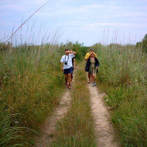
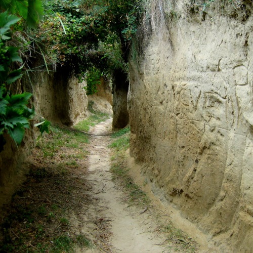
This journey starts at Susak’s patisserie in the lower village. Walk into a street right of the patisserie and enter a smaller ally. On the wall of one of the houses you should see a hiking trail blaze like this one:  - a red circle with a white center. Keep going straight and after about 50 meters you should get to the beginning of the well-worn steep dusty path - the one leading to the lighthouse.
Since the path is covered with a thick layer of loose dust, it’s a good idea to take off your shoes - to keep them clean. After about 50 meters the trail becomes less steep and less dusty, so you will be able to put your shoes back on. At about the same moment start looking for an narrow exit on the right side - it leads to the best scenic point of the island - the flagpole hill just above the harbor. It offers a great view of the lower and the upper village and it’s definitely worth visiting!
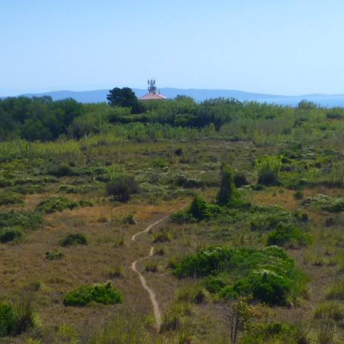
After taking a few photos turn back, return to the main path leading to the lighthouse and continue walking uphill. Within a few minutes the trail will become flat and you should be able to see the lighthouse tower in the distance. Along the way you will walk pass several scenic points on the left.
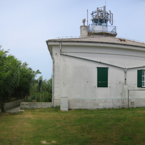
In another few minutes you will reach the lighthouse. The lighthouse keeper and he’s wife are very friendly and approachable people from who you can learn a lot of interesting information. If you ask they might take you for a tour of the lighthouse tower.
Continue your journey by following the path leading from the lighthouse into the grassy highlands behind it. In about 100 meters you will reach a county road from which you’ll see the watchtower of the abandoned military outpost in the distance. Take the path leading from the road in the direction of the watchtower.
In about 5 minutes you’ll reach a high wall surrounding the outpost - the entrance is on the right side. Although the building is in poor condition, entering it is quite safe. In the middle of the building there there’s ladder leading to the top of the tower. The ladder however is not safe for climbing - you do it at your own risk.
Meadows surrounding the outpost are criss-crossed by many paths, which unfortunately don’t lead anywhere - they have been made by sheep, who from time to time live there. If you’re for an adventure, you can try taking one of these paths to see where it will take you. Who knows - you just might hit a jackpot and discover a new and interesting place!
When you’ve had enough of sheep trails and abandoned buildings, head back and return to the county road. When you reach the road, turn right - away from the lighthouse. This road will take you to the upper village. After about 20 minutes you will reach a paved path which connects the upper village and the cemetery - turn left for the upper village.
As you reach the first house of the upper village on the left you’ll see stairs going down. These are the second stairs connecting the upper and the lower village. Turn left and follow the stairs.
End your journey at the Emigrant’s club. There you can have a cold dring to celebrate your adventure!
GPS
Along the way there’s a hidden geocache. For mora info on geocaching click here.
If you’re really into GPS stuff, you can even download a tracklog, which will guide you along the way.